Heavy storms set to hit Plains, new storm systems develop over Atlantic
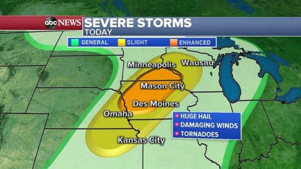
More severe storms are expected in the Plains today as 90 damaging storm reports took place around the country yesterday including 11 reported tornadoes in Wyoming and South Dakota.
Interested in Weather?
Some of the worst damage occurred in Sioux Falls, South Dakota where authorities are warning people not to go into the city due to storm damage and downed power lines.
Severe weather threats will expand today from Wyoming all the way to Wisconsin with the biggest threat being damaging winds and huge hail with possible tornadoes. Hail the size of grapefruit fell in areas of Wyoming yesterday and winds gusted up to 82 mph in Valentine, Nebraska, and 71 mph in Platte, South Dakota.
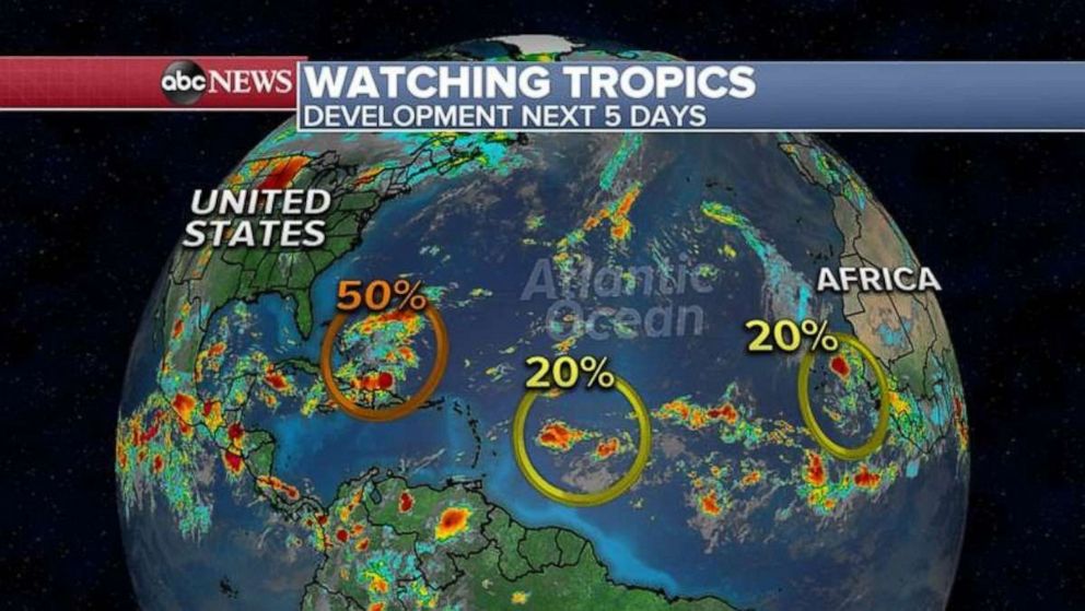
Elsewhere, yesterday was the peak of the Atlantic hurricane season as several tropical storm systems are developing.
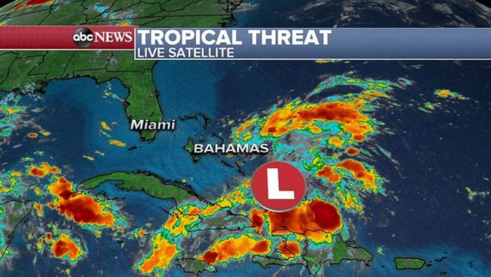
A tropical low is currently hovering over the southern Bahamas and will bring rain and a few thunderstorms to the northern Bahamas in areas that are trying to recover from Hurricane Dorian.
Several models are showing this storm system moving over Florida later this week and possibly reemerging in the Gulf of Mexico as a tropical low.
The National Hurricane Center is giving it a 50% chance for development into a tropical depression or tropical storm this weekend.
But regardless of formation, heavy rain is expected from the Bahamas into Florida and possibly the Gulf Coast into the Weekend and end of the week.
Source: Read Full Article


